Google has already become the most significant societal knowledge access tool. Google Earth adds the geospatial dimension and enables systematic analysis and monitoring of natural and regional and urban ecosystems. Google Earth and maps, like Apple Maps and Bing Maps, make use of satellite and airborne remote sensing and air photo images from Government and Private Sector satellite systems such as Landsat, Spot Image, Digital Globe.
Since the first Earth Resources Technology Satellite was launched by NASA in 1973, access and ability to analyse these images was primarily limited to selected government, research and private sector organizations with the technology, tools, and financial resources. Google Earth was launched in 2005 (Wikipedia Link) revolutionized access and provided simple but effective geographic information system tools for integrating other maps, digital terrain models, measuring, and creating new maps. This new unique tool combined with GPS has changed our lives especially where travel and transportation are involved.
However, the real societal revolution of this 'geospatial' technology is still to come when it spatially combines, integrates and analysis big data from socioeconomic and environmental information and monitoring systems in real time.
We were fortunate to get involved in the very early stages of Satellite and Airborne Remote Sensing Systems through the Canada Centre for Remote Sensing; very early involvement with application of GIS systems through the Canada Land Inventory's Geographic Information System the CGIS, the World's first GIS. Many of our present explorations are inspired by this earlier work.
About 8200 years before present, Glacial lake Agassiz was the largest lake in the world. It covered over 840'000 km2 in Canada (Manitoba, Saskatchewan, Ontario) and the US (North and South Dakota and Minnesota).
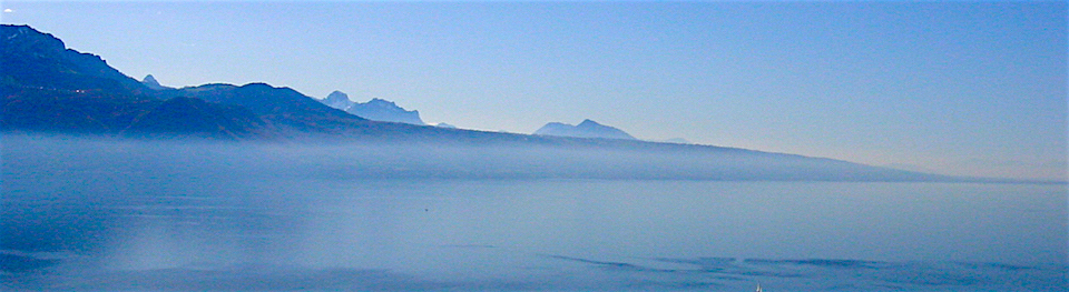
In this time of Climate warming it is particularly interesting to study some of the past changes in climate. Google Earth provides a unique tool to explore the maximum extent of this lake and its ultimate recession and drainage.


Reconstructing the past with Google Earth:
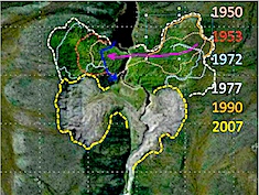
1926 and 2007 permafrost comparison


