The Canada Land Inventory provides one of the most comprehensive digital map source for resource planning and management in Canada. The area covered by the CLI is indicated in the index map. For each of the map sheets areas land capability is mapped at 1:250'000 scale and usually at a 1:50'000 scale. This is an example for Mapsheet 11D Halifax, Nova Scotia. The index map on the right shows the areas mapped for land capability under the CLI. The left image shows an example of a number of overlays displayed on Google Earth.
Each of the 1.250'000 scale maps has an extensive description of the landscape ecosystem and capability perspectives. Below is an example for the Halifax map area.
INTRODUCTION
CLIMATE
SETTLEMENT AND LAND USE
ECOLOGY
WETLAND CLASSIFICATION
VEGETATION
FOREST CAPABILITY
LAND CLASSIFICATION FOR UNGULATES
RECREATIONAL CAPABILITY
AGRICULTURE
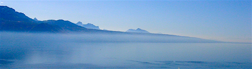
The Halifax map sheet area is situated in central Nova Scotia and borders the Atlantic Ocean from Liscomb Island to Ingramport. The area is characterized by innumerable lakes and a highly dissected coastline and has a wateroriented recreation potential.
The Southern Upland, which is underlain by granite, quartzite, and slate, is a remnant of the Atlantic Uplands of Nova Scotia. Worn down by erosion to thousands of low hills and smooth-topped ridges with intervening lakes, bogs, and rivers, it reaches altitudes of 600 to 700 feet. The Southern Upland covers all of the area except for several small portions near Ardoise Hill, Elmsdale, and Elderbank, which are projections of the Hants-Colchester Lowland. Carboniferous sandstones, limestones, and shales are responsible for the long, smooth slopes that are characteristic of the lowland.
Glacial depositions in the form of drumlins occur along the coast near Halifax and Dartmouth.
The numerous offshore rocky ledges and barely submerged reefs make boating extremely dangerous for those not familiar with the coastline. Tidal fluctuations are generally less than 5 feet. Frequent driving winds and cold water limit the recreation potential of exposed beaches.
Much of the land area is productive forest and supports mixed stands of red spruce, balsam fir, hemlock, white pine, maple, and yellow birch. Wire birch mixed with balsam fir, black spruce, alder, and scrubby bushes cover the barrens and burned-over portions scattered throughout the Upland. The many peat bogs support only mosses, cattails, and sedges. Cleared lands occur mainly in the lowlands and on the drumlins.
The climate is humid temperate and is characterized by few extremes. The spring
season is prolonged and the summer short and cool. Average temperatures
range from about 200F in February to about 650F in August. Rainfall
is moderately heavy, generally from 45 to 55 inches annually, and is
quite evenly distributed throughout the year. Snow comprises 16 percent
of the total precipitation, but does not accumulate. Frequent ground
fogs occur along the Atlantic coast, but they are generally dissipated
before noon of the next day.
Before the middle of the eighteenth century, the coastal locations were virtually unpopulated. Temporary fishing and trading posts were periodically built in secluded coves, but no permanent settlements were established.
Halifax was established in 1749 by the Honorable Edward Cornwallis and 2500 settlers of English, Irish, and Scottish birth. Subsequent arrivals of more craftsmen and settlers from New England and Europe stimulated growth of this port. Now the greater Halifax area has a population of over 200,000 people and is the principal shipping, manufacturing, and distribution center in Nova Scotia.
By 1775, several insubstantial fishing villages, including Tangier, Jeddore Harbour, and Musquodoboit Harbour, were struggling to survive along the Atlantic Coast east of Halifax. Development was slow and even today the villages are small and mainly oriented to the sea. Except for the lowland portions, farming is secondary and fishing and forestry are the basic industries of the settled districts.
Gold was first discovered at Mooseland in 1858. Gold mines, which were confined to the slates and quartzites of the Goldenville formation, were started throughout the area. Most of these petered out in a few years, but some produced steadily for many years. All the mines are now closed or worked spasmodically when new veins are discovered.

The area is predominantly covered with forests, except for scattered barren rock outcrops and the narrow floodplain of the Musquodoboit River, which is occupied by small farms. There are four main forest districts: the Eastern Shore, the Sheet Harbor, the Musquodoboit Hills, and the Halifax.
The Eastern Shore forest district is a narrow strip, 5 to 25 miles wide, along the coastline. White spruce (Picea glauce) is dominant along the coast, but is less common inland. Black spruce (P, mariena) and balsam fir (Abies balsamea) have adapted to the rigorous climate, but their growth is slow. Very dense stands are common. In the Sheet Harbor district red spruce (Picea rubens), balsam fir, yellow birch (Betuls lutes), hemlock (Tsugs cansdensis), and white spruce are common. Seech (Fsgus grandifolia), red maple (Acer rubrum), and sugar maple (A. saccharum) grow on hills with deeper soils.
The Musquodoboit Hills district has balsam fir and white and red spruce on the lower slopes, valleys, and flats. The upper slopes support sugar maple and yellow birch. The Halifax ecodistrict is quite different from the other forest districts. White pine (Pinus strobus), red spruce, and hemlock stands have been destroyed by fires and have bean replaced by red oak (Ouercus rubra), red maple, and white birch (Betula populifolia), which grow poorly on the shallow soils. Black spruce is generally mixed with these hardwoods.
A saltwater and a freshwater plant community occur in this area. Aquatic plants are scarce in many lakes because of water depth, low fertility, and lack of a rooting medium. Most of the inland waters are acidic, especially in and near the numerous bogs. Plant species of the freshwater community include waterlilies (Nymphses spp. and Nupharspp.), sweet gale (Myrica gale), rushes (Juncus spp.), arrowheads (Sagittsria spp.), and burreeds (Spsrgsnium spp.).
The saltwater plant community occurs along the coast and in water regions that appear to be lakes, but are connected to tidewater. Lack of rooting media and edge prevent abundant aquatic plant growth. This community consists of sedges (Carer spp.), rushes (Juncus spp.), cordgrasses (Spartina spp.), and eelgrass (Zostera marina), which is somewhat rare.
The waterfowl species that nest in the area are ring-necked ducks, common mergansers, common goldeneyes, and black ducks.
Most of the wetlands are deep, steep-sided, oligotrophic lakes, which are rated Class 6z. The wetlands with the highest capability for producing waterfowl are in the floodplain of the Musquodoboit River. These are rated as Classes 1, 2 and 3.
Nearly all the coastline, including most of the offshore islands, is a migration habitat for waterfowl. Large numbers of eiders, scoters, scaups, mergansers, black ducks, and Canada geese have been observed here. Hunting of sea ducks is a common sport along the coast, whereas dabbling ducks are hunted on fresh water.

The pedominant tree species in the Eastem Shore District are black spruce and balsam fir. Coastal stands of fir tend to be dense, and many are windswept and stunted. White spruce prevails along the coastline. Farther inland, the forest is characterized by pure and mixed stands of red, white, and black spruce, balsam fir, larch, white pine, hemlock trembling aspen, red maple, and yellow end white birch. Occasionally beech and sugar maple occur. Excellent old growth red spruce and hamlock stands occur in the northwestem part of the area. Fire barrens and rocklands are common in the southwest and are characterized by stunted wire birch, black spruce, and a dense growth of sheep laurel, blueberry, rhodora, and huckleberry. Swamps and bogs occur throughout the area and are generaly characterized by black spruce, larch, red maple, alders sphagnum moss cattails and sedges.
Most of the area is covered by shallow, coarse-textured soils derived from granites and quartzites. The capability of these soils, if not depleted by recurring fires ranges from 31 to 70 cubic feet per acre per year. Tracts of deeper clay loam to sandy loam till located in the northwestem and north-central parts of the area have a potential yield per acre per year of 51 to 70 cubic feet on the well-drained sites and 31 to 50 cubic feet on the imperfectly drained sites. Numerous fire barrenaswamps, bogs and rocklands occcur throughout the area and yield at best 30 'cubic feet. Exposed bedrock, boulder-covered terrain shallow soils, dense heath vegetation, and poor drainage severely limit the capability of these areas for forestry.

Capability classification by R. E. Bailey and G. E. Mailman under the direction of R. M. Bulmer of the Planning Division Nova Scotia Department of Lands and Forests end the Canada Department of Forestry and Rural Development 1970.
REFERENCE
Loucks O. L. A forest classification for the Maritime Provinces. Proceedings of the Nova Scotia Institute of Science. Vol. 25, pert 2, 195860.
LAND CLASSIFICATION FOR UNGULATES
ndiscriminate land clearing and unplanned forest exploitation have greatly altered the forest succession over most of the area. Except on some small islands, which are limited by size or topography, whitetailed deer (Odocoileus virginianus) and moose (Alces alces) are found throughout the forested parts of the area. Although moose are uncommon, both moose and deer are considered to be indicator species the area. Patterns of landforms rather than separate features have been classified, and as a result, very on the map. Along the coast, exposure is an limiting factor, but inland, shallow soils and poor soil moisture conditions limit productivity for food and cover species. Lands with capability for deer, which is the most important species, have mostly been rated Classes 4 and 5; there area few Class 3 lands. Much of the coastal region has been rated Classes 5, 6, and 7. In the eastern part of the area, however, much of the coast provides wintering range, and deer may migrate as far as 20 miles to this land.

The maples, birches, and beach are the favorite trees for browse. 0f the shrubs witherod (Viburnum cassinoides), striped maple, (Acer pensylvanicum), and beaked hazel (Corylus cornuta) are preferred. Speckled alder (Alnus rugosa) is also eaten.
Generally, acess is fair. Hunting pressure is moderate, and nonresident hunters are few. In general, present land use practices do not adversely affect ungulate production, but a winter range management program for deer could increase the use of these lands.
Capability classification by Nova Scotia Department of Lands and Forests.
The area is drained to the Atlantic Ocean by an intricate network of lakes, brooks, streams, and rivers. Lakes throughout the barrens have a high capability for fishing and canoeing but a low capability for boating and cottaging. Water bodies scattered throughout the portions of the area with deeper soils are much more attractive for family-oriented recreational activities and have a high capability for camping, cottaging, boating, fishing, canoeing, and associated activities. Speckled trout are caught in most water bodies and Atlantic salmon are caught during their spawning runs up the main rivers. The rivers and streams are navigable only by canoe and their interlocking nature provides excellent canoe tripping opportunities. Rapids and waterfalls occur in all rivers where the water crosses dykes of granite and ribs of quartzite. Many are unnamed and unclassified, but a number are very attractive and have the capability for supporting activities such as camping and picnicking.

Attractive beaches of pure sand occur in a number of coves along the highly irregular coastline. However, many are severely exposed and fronted by cold water and thus have a limited recreation potential. The beaches that are sheltered have become favorite gathering spots for local residents.
Many sections of the coastline are highly scenic because of their land mass irregularities and their picturesque fishing villages in rugged settings. The offshore bars and reefs limit pleasure boating considerably and exposure factors reduce the capability of the headlands and points for cottages and camping.
There are many significant historical sites and buildings located throughout the Halifax area, including the Martello Tower (1796), St. Mary's Basilica (1820), Province House (1818), and Citadel Hill. At Mount Uniacke, Richard John Uniacke's country house, built in 1797, is now preserved and operated by the Provincial Government.
Capability classification and descriptive narrative prepared by Parks Division, Department of Lands and Forests. Province of Nova Scotia.
Farming in the area is confined almost entirely to the soils developed on drumlins scattered over the area from Sackville to Ecum Secum. Some of the formed land of the vicinity of Sackville, Dartmouth and Cole Harbour is ured for truck crops. The remainder is used for dairying and mixed farming. Most farmers, from Enfield to Truro and east to Upper Musquodoboit. have fluid milk contracts with distributors in the Halifax-Dartmouth area. Only about 17.000 acres are farmed in Halifax County and much of thir ir north of the mop area. An 18 percent reduction in improved farm land occurred between 1951 and 1961. Some of this land is occupied by nonfarming rural residents. Other areas have been lost to urban growth.

There are no Class 1 soils in the province.
Soils in Class 2 with subclass S are low in natural fertility but have no other limitations great enough to effect the class level. Class 2 soils with subclass I are moderately fertile but are subject to moderate flooding.
Soils in Class 3 with subclass S have been reduced two classes because of low natural fertility and either droughtiness or low permeability. Class 3 soils with subclass P have been reduced two classes because of low natural fertility and presence of stone or cobble. Class 3 soils with subclass I are subject to either moderately severe flood damage or moderate flood damage and moderate frost hazard
Soils in Class 4 with subclass S are reduced one class because of low natural fertility and two classes for severe droughtiness or very low permeability. Class 4 soils with subclass T may have a variety of limitations in addition to low natural fertility and adverse slope or pattern. They may, for example, be droughty, or stony, or shallow. Surrounding soils with like characteristics but without the unfavorable slope pattern may be placed in Class 3.
Capability Classification by J. D. Hilchey and J. I. MacDougall, based on soil information contained in Nova Scotia Soil Survey Report.
[Table of Contents]
