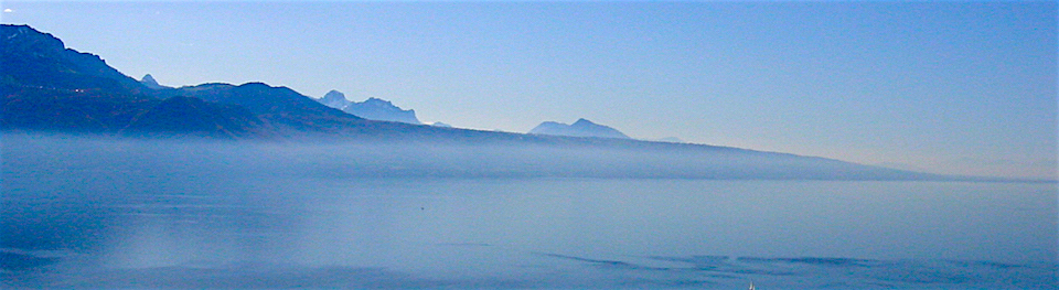


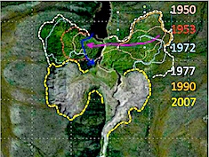
Over a 60 year period these permafrost landslides regress like glaciers!....


... consulting services linking spatial science, policy, and practice in pursuit of better understanding of ecosystems and a sustainable world....
Strategy mapping; Future dialogues; strategic architecture
Influencing the policy cycle, Science-policy cartography, Issue and policy maps; National Atlas Maps;
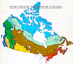
Forest fires, Land use, wetlands, permafrost melting; habitat; flooding and flood risk
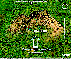
Permafrost, beaver habitat, forest fires, exploring glacial lake Agassiz; Wood Buffalo National Park etc.
Highest densities, longest beaver dams, largest beaver landscapes in Canada and around the world
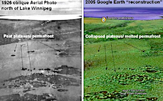
Measuring a hundred years of change in permafrost(peat plateaus and plasa's) in Canada's wetlands
Concepts, strategies, business models; societal and policy application of national atlas and issue maps
Application, impact, innovation and history of one of the World's largest multi-disciplinary resource inventories; Canada's critical lands
Monitors land use change following the completion of the CLI program, with special focus on urbanization, agriculture and wetlands.
And the Canada Committee on Ecological Land Classification (CCELC; Its history, and impact on ecosystem classification, ecological surveys, national environmental policies and maps.
Integrated regional overview of environmental and social aspects of present land use in Northern Canada
From Spatial Data (SDI) to Spatial Knowledge Infrastructure (SKI); Future of Geomatics; Canadian Institute of Geomatics and Geomatica- The Canadian Journal of Geospatial Science, Technology and Practice


EcoInformatics International Inc. - Ottawa, Ontario and Wakefield, Quebec, Canada